


App截图
App介绍
Mt.Fuji-GPSTrailMap是一款导航类型的app,为您提供最新Mt官方IOS版下载。
Mt. Fuji App is a hiking trail map application that can be used as a GPS for climbing, hiking, trekking, trail running, and other outdoor activities.
It utilizes data such as maps, routes, and place names that can be used for climbing Mt. Fuji, and allows you to check your current location with GPS even in the mountains where the Internet connection is not available.
Features
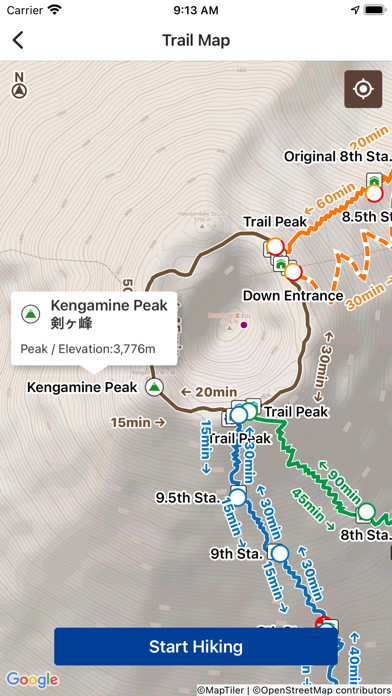
(1) Offline trail map
Mt. Fuji trail maps can be used offline.
Even in the mountains where there is no internet connection, you can use the signal from GPS satellites to locate your current location and display the map.
(2) Easy preparation
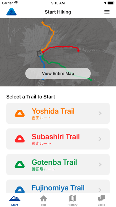
You can start hiking by simply selecting your trail route from the four routes commonly used for climbing Mt. Fuji.
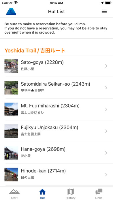
(3) Mountain hut/lodge information
You can also make reservations by phone or through the website for huts located along your planned route.
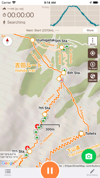
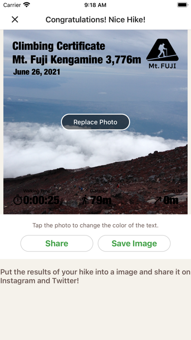
(4) Leave history of your hike
When you start climbing a mountain, you can store a GPS log of your hike using GPS.
Even if you are on airplane mode or out of range, if the sky is open, you can store a GPS log using satellite signals.
After you finished your hike, you can get your own Climbing Certificate of Mt. Fuji.
(5) Voice notification of wrong way
When you deviate from the planned route, you will be notified by voice.
You can also use the speech function that periodically notifies you of the current time and elevation after you start climbing.
(6) Easy to keep a record of your hike
You can easily create a record of your hike using the GPS logs and photos you took while climbing!
You can also export the GPS log or post it directly to Yamareco (in Japanese only).
(7) Latest Mt. Fuji conditions
By signing in YamaReco, you can check other people's Mt. Fuji records and check the current mountain conditions.
Knowing the current mountain conditions can help you prepare appropriately.
(8) Useful links
The app includes links about mountain insurance, mountain gear, transportation, and other preparations necessary for climbing Mt. Fuji.
Notes
When keeping a GPS log, the GPS function is used continuously in the background, which may drain the battery faster than apps that do not use GPS.
Continued use of GPS running in the background can dramatically decrease battery life.
Please be sure to bring a paper map, compass, spare batteries, and power cable with you when climbing mountains.
To use some of the functions of this application, you will need to register as a user with YamaReco.
How to use the application
https://sites.google.com/view/fuji-ios-en/
对Mt有什么评价可以在下方的评论中和大家分享。如果是其他问题可以直接联系Mt的官方。
热门用户评价
最近更新
- 食之契约飨灵百科-土豆泥评测 2019-11-21
- 龙灵下载方法-葫芦侠怎么下载龙灵 2023-04-07
- 长月烬明电视剧剧情是什么-长月烬明剧情介绍 2023-04-07
- 小鸡答题今天的答案3月30日-小鸡答题今天的答案是什么 2023-03-29
- 蚂蚁新村今日答案最新3月24日-3月24日蚂蚁新村答案 2023-03-24
- 华为matex3发布时间-华为matex3什么时候发布 2023-03-16
- 少年西游记紫金神将评测-瑶池王母 2019-10-02
- 小鸡宝宝考考你杜甫名句泥融飞燕子沙暖睡鸳鸯描写的是哪个季节的景象 2023-04-08
- 德班世乒赛举办地介绍-2023德班世乒赛在哪里举行 2023-04-03
- 蚂蚁庄园325答案最新-哪种动物不会眨眼睛 2023-03-25
- 方寸对决下载方法-光环助手怎么下载方寸对决 2023-03-24
- 副业兼职轻松月入过万是真的吗 2023-03-26
- 坦克大决战赛季通行证-荣誉纹章介绍 2019-09-08
- 荒岛求生新玩法上线-挑战难度再升级 2019-09-04